Subscribe To A History Garden
Wednesday, April 12, 2023
Saturday, April 8, 2023
South Kingstown at 300: Small State Big History Article Part 1

This year marks the 300th anniversary of the creation of the town of South Kingstown. When I realized in late January that the community that was so much the focus for my MA thesis was celebrating the most noteworthy birthday that would take place during my lifetime, I began writing an article about its conception and birth.
Actually, what I did is I went to the chunk of my thesis that focused on the history of South Kingstown up to the point of its incorporation -- originally written sometime between 11 to 14 years ago -- and I began re-reading, editing and updating it for eventual publication somewhere in connection with the 300th anniversary celebration. This the town of South Kingstown is celebrating with year-long series of events they are calling "SK300."
I sent out an email to Christian McBurney, the editor and owner of "Small State Big History: The Online Review of Rhode Island History," and he wrote back that he would be interested in publishing an article on the early history South Kingstown as soon as it was ready. I also reached out to the South County Museum and told them I would be available to speak on the subject, and they gave me a date this summer (July 12, 2023, iirc) to present the topic to their members.
Now that I had some proper deadlines to agonize over, it was time to get to work!
On February 16, my friend archaeologist Joseph "Jay" Waller gave a lecture for SK300 on the prehistory and archaeology of South Kingstown. Since I have a standing dinner date with my daughter on Thursday's after her track practice and before dropping her off at her mother's, I was unable to make it to his presentation, But I have seen several talks Jay has given on the subject of RI archaeology and the pre-contact Narragansett village known as "RI 110" and I highly recommend watching the video of Jay's SK300 presentation here. The parts of my thesis, and the article for SK300, that explains the culture and society of the Narragansett people before the arrival of Roger Williams in 1636, partially relies on his research, so mad props to Jay Waller. And props to Executive Director of the Tomaquag Museum Lorén Spears as well, who took the time to meet with me to discuss pre-Contact and 17th century Narragansett settlements back in the days of my thesis research.
Lorén actually gave the first history presentation for SK 300 back in January -- “Kumagooaunash Numanutoom, All Creator’s Gifts.” I would very much liked to have seen it, but I was unaware of these presentations were happening or even that SK300 was a thing when she gave it. Unfortunately there is no recording of Lorén's talk on the South Kingstown website like there is for all the other SK300 presentations...
Anyway. I was making good progress on the research and rewriting for the SK300 article, but then running Rhode Island Model Legislature 2023 took up most of the month of March.

 |
| RI Representative David Cicilline giving the 2023 Keynote in the House Chamber RI Model Legislature March 25, 2023 |
 |
SK300 advertisement on Facebook for Christian McBurney's presentation of the Narragansett Planter's slave economy, circa 1660-1783 |
I told him of course he could use my map. I was also able to attend his SK300 lecture on March 30, 2023, as my daughter couldn't make our dinner date because she had dress rehearsal for Swan Lake immediately after track practice that night.
It was so cool to see my "Map of Land Acquisitions in Rhode Island, 1657-1662" up on the screen!
 |
| Christian McBurney and my map "Land Acquisitions in Rhode Island, 1657-1662," from my MA thesis |
Besides identifying and reading the various relevant sources that had been published in the decade or so since I finished my thesis, I decided to go to the South Kingstown Town Hall and track down the so-called "town charter." I recalled that while researching my thesis all those years ago, I had stumbled across a typewritten version of the town charter tucked in the back of one of the town meeting record books.
I not only found it, but thanks to Susan Flynn, the current town clerk and her fabulous stick note, I was also able to identify the town clerk who had transcribed the charter back in 1936!
 |
| Sticky note from the current town clerk with Howard Perry's info, which now lives on the wall in my office. Perry was SK town clerk for about 55 years...it was not uncommon for SK town clerks to serve for decades. |
 |
| South Kingstown's typed-out charter, transcribed by Town Clerk Howard Perry in 1936 |

 |
| The "original" charter, as drawn up by Richard Ward, General Recorder for the Colony of Rhode Island, on April 30, 1723. This document can be found on pages 31-32 in South Kingstown Meeting Records Vol. I, 1723-1776 |
 |
| The SK Town Records Vault. Entry is now "by appointment only," which is new from my thesis research days. I bet this place was crazy though during the pandemic real estate boom... |
 |
| South Kingstown's Town Meeting Records, 1723-1919. Fun fact: South Kingstown has the most complete set of town records in the state of Rhode Island. |
 |
| Side view of the South Kingstown Town Hall. The stone structure on the right was built in 1870s; the modern section on the left was constructed I believe in the 1970s. |
At any rate, here is the link to part one of my article. I hope you enjoy it, and give it a 💗 if you did!

Friday, December 30, 2022
1968 Cougar XR7-G

The 1968 Cougar XR7-G. Only about 600 of these "Shelbyized" Mercury Cougars were ever built. It came with a choice of five different engines, from a 302 to a 428, and four transmission choices, depending on engine selection.


Please drop one off at your convenience, preferably in dark green or black, but any color really as long as it has a clean title. I'll trade you for a really good sandwich.
_________________________________________________
Images and full history of this rare and beautiful cat can be found at performance.ford.com/enthusiasts
Wednesday, December 28, 2022
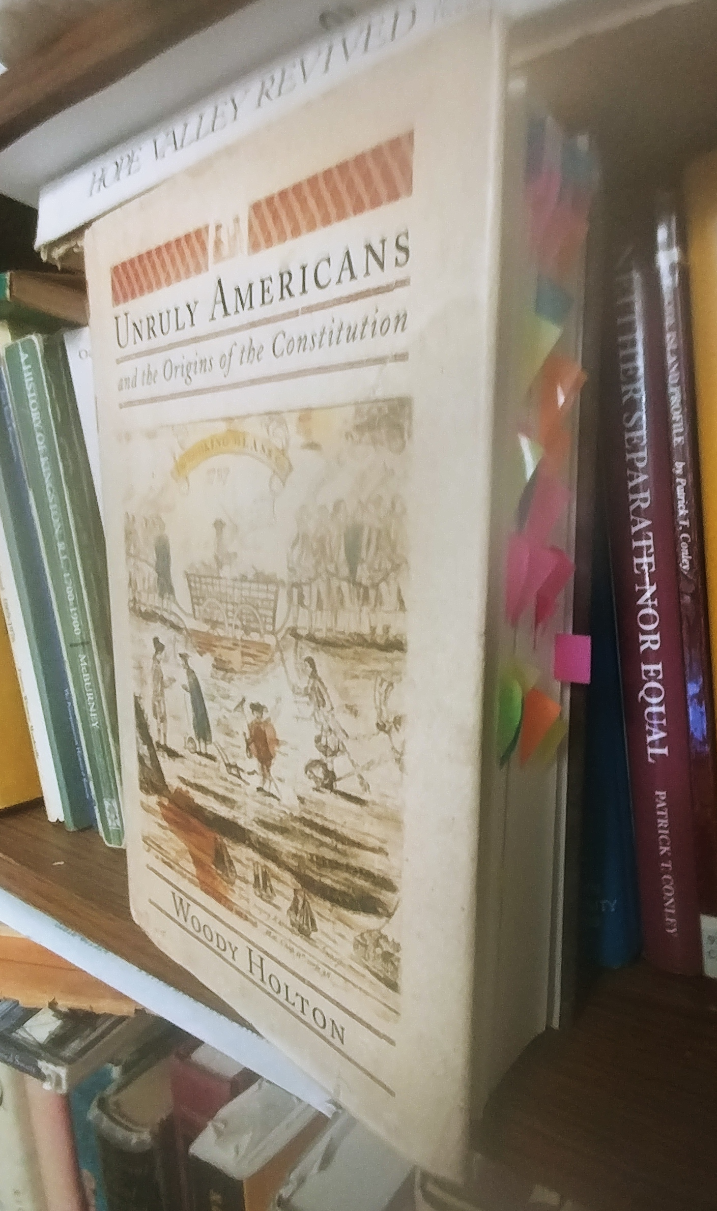
Woody Holton, Liberty Is Sweet (2021)
While researching my MA thesis, I spent some time studying the work of Woody Holton, McCausland Professor of History at the University of South Carolina. At the time, I was most interested in his 2007 book, Unruly Americans and the Origins of the Constitution. My copy is still bedecked with twenty or thirty Post-it® note text flags sticking out of the text block. Unlike many historians of the Revolutionary era and the so-called "Critical Period," Holton understands the outsized role the antics of Rhode Island's Country Party played spurring the growth of the Federalists and the push to draft and ratify the US Constitution. Rather than drawing Rhode Island politics as a caricature of anarchy and vice, an image originally drawn by those same Federalists but repeated ad nauseum by numerous historians who can't be bothered to actually read actual first-hand accounts of Rhode Island history, Holton's book was very useful in helping me to contextualize 1789s RI politics with the broader national narrative.
More recently, Professor Holton was the keynote speaker at an April 2015 conference I attended at the Massachusetts Historical Society, "So Sudden an Alteration": The Causes, Course, and Consequences of the American Revolution. I have a binder of panel papers and other documents from that conference, which was just killer, killer!
Here is Professor Holton delivering the keynote; I didn't have the greatest seat but I also could have left earlier for the conference and gotten there in time to snag something closer than this...

I also ran into my thesis advisor, Ron Dufour at the conference. Here we are, photograph courtesy of historian Gordon S. Wood:

I really should stop by Rhode Island College this semester and look up Ron... I've been in contact with him maybe once or twice via email in the almost 8 years since Professor Wood took this picture of us, and in person not even once.
Anyway, I was looking through some NCSS (National Council for the Social Studies) emails earlier, as I am remiss in filing some paperwork with them for the Rhode Island chapter which brought me to the NCSS website. As usual, once there I was looking at stuff which had little to do with my paperwork and I came across a page of National Humanities webinars the NCSS recorded for PD. And on that page I discovered Professor Holton's talk on his most recent book, Liberty is Sweet: The Hidden History of the American Revolution, published in 2021. And in the interest of passing along good history to whoever happens upon this webpage, below is the NCSS blurb for the webinar and below that, a recording of his lecture,
In his book, Liberty is Sweet, Woody Holton’s “hidden history” of the American Revolution, nothing is quite what it seems. The painting on the cover seems conventional: a pistol-wielding Patriot foot-soldier captures two British horsemen…but the Patriot turns out to be a woman in drag. The phrase “Liberty is Sweet” sounds like the sentiments of Thomas Jefferson or Benjamin Franklin but actually comes from a 1775 letter describing George Washington’s slaves’ aspirations to escape Mount Vernon. Holton entitles his preface “Invisible Enemies” in a nod to the Native Americans who were long omitted from the story of American Independence but actually played a crucial role in bringing on the Revolutionary War and shaping its course. And these are far from the only surprises in Holton’s astounding reappraisal of the founding of the United States.
Participants in this webinar will read some of the most surprising documents Holton found while researching Liberty Is Sweet, then discuss and debate their meaning with the author.
Note that the first 9 minutes and 4 seconds is just housekeeping NCSS stuff, and after that timestamp, the video turns to Woody Holton and his discussion of his book, Liberty is Sweet: The Hidden History of the American Revolution.
Monday, August 29, 2022
Dean's Mill Park: A Mystery on a Postcard
I came across this post by RoadTrip New England on the Old images Of Rhode Island page, a private group on Facebook that posts a lot of interesting images of Rhode Island.

The first response to the post was "I’m guessing Dean’s Park or the boulder doesn’t exist anymore?" which is an understandable response.
I grew up in Charlestown, which was part of Westerly until 1738, and I hiked the management areas and trails all over the area. I had never heard of a Dean's Mill Park near Westerly either.
There are other images on eBay of that particular postcard, two in black and white and postmarked with the date of 1906. Hippo.com, another online purveyor of antique postcards, had one in color with a long written note on the back, but without a postmark or date in the text. Then there were two other postcard's, one captioned "Dam at Dean's Mill Park" from c. 1905, and a different "Dean's Mill near Westerly RI" dated September 1909 (pictured below):


But neither Dean's Mill or Dean's Mill Park come up in a Google maps search of Westerly. I thought it might show up on a late 19th / early 20th century map, but the nearest map in time to the postcard, the 1895 Richards & Everts map of Westerly is focused on what is the "downtown" area of Westerly and Pawcatuck and there is no Dean's Mill there. But in my survey of sites for the "Lost Mill Towns of South County" project, I had never read about a Dean's Mill in any of the several other mill villages around Westerly.

A search of the RIHPHC March 1978 survey of Westerly makes no mention of Dean's Mill either, and unlike the Richards & Everts map, that is a review of the history and architecture of the entire town, not just the downtown area. And while the RIHPHC surveys are not one hundred percent foolproof, that a) I had never heard of it in 50+ years of hiking around the area, that b) I couldn't find Dean's Mill on any Westerly maps, and c) that it was not in the state survey or in any other research I've done -- confirmed my suspicion that despite the caption this postcard image was not of any place in or near Westerly.
But that is a rather unique glacial erratic near a stone wall -- and the image, that frame of reference, everything in there -- should still be there unless it was blasted out and removed for a housing development or to widen the road.
The view seen from the postcard is easily recognizable. Its just a matter of figuring out where to stand to see it, if not "near Westerly."
Then I found another clue -- there's a Dean's Mill School on Dean's Mill Road not in Westerly but one town over, in Stonington CT. The northern terminus of Dean's Mill Road begins on Pequot Trail/RT. 234, then it travels east of Deans Reservoir, which was created by damming Cobbs Brook. The mill pond is bisected by Rt. 95 (and becomes Mystic Reservoir south of the interstate), then Dean's Mill Road crosses Mistuxet Ave / Pellegrino Road (it's a weird intersection) and ends in the south on Flanders Road. The northern section of Dean's Mill Road that runs past the reservoir is very narrow and you can't "drive down it" on Google Maps, though it has a town speed limit sign of 15 MPH and another sign warning of a "Narrow Road" and so it must be maintained to some degree by the town of Stonington. The section of Dean's Mill Road south of the intersection with Mistuxet Avenue and Pellegrino Road is much wider and is where Dean's Mill School is located.

There is no Dean's Mill Park on Dean's Mill Road but there but there is a Deans Mill Preserve off Jerry Browne Rd on the western side of the reservoir (in red on the AllTrails map below). The park in the postcard may very well be part of this preserve -- AllTrails doesn't say. But where to stand to see the frame of reference of the postcard? We are much closer to answering that question now!
Given this postcard was printed by assorted RI printers, the caption "Near Westerly RI" for a scenic park in Stonington makes sense. Rhode Islanders and tourists visiting RI would be more likely to purchase and use the postcard if it said the image was "near" a well-known central place in Rhode Island than if it was labeled "Stonington Connecticut."

Below is an 1868 map from An Atlas of New London County by Beers, Ellis & Soule of the area in the AllTrails map - (there is a higher resolution version of this map here). What is Dean's Mill Road follows the exact same track on the 2022 and 1868 maps.

The reservoir area is circled in red -- the mill pond is much much smaller than the Mystic/Dean's Mill Reservoirs are today and at the southern end there is a point symbol labeled "G. Mill," for grist mill. My guess based on AllTrails and the maps was that Dean's Mill was a manufacturing concern located on the western side of Copps Brook opposite from the grist mill, and was in business sometime after 1868 and before 1906.
Then as I started putting all these pieces together in this blog post, it came to me that a search of the actual place, Dean's Mill Park + Stonington Connecticut might yield much better search results. That search proved to be much more fruitful, as one might imagine.
I quickly found the The Quiambaug/Mistuxet Valley website, a very thorough look at this area of Connecticut put together by one Bryan A. Bentz [2]. This had all the information I was hoping to find about this mill site:
Built "long before the Revolution" according to Grace Wheeler [1]... the home of the Stanton Brothers is south of Pequot Trail, along what was once a public road between Pequot Trail and the upper dam across the reservoir. The road is now a very long driveway; I expect few have intruded enough to see this magnificent house.
 |
| The Stanton Bros. home, between Pequot Trail and the upper dam Image credit: qb.mindhenge.org/structures.html |
Grace mentions Frank Stanton's large family (five sons and four daughters: "...a great part of the pleasure of the nearby society would center about them; many a sleighing party and dance was quickly gotten up". She goes on to further describe the road down to the upper dam:
The path from the Stanton House to the Dean's pond is a most romantic, winding road. This has been an historic place in the town's history. The old house at Deans Mills was built by James Dean Jr., in 1700, and it was burned down in 1848. Mr. James Dean Sr., lived at Quiambaug, just east of the Quarry ledges. Very near this second Dean house was an immense rock, which still stands a silent and immovable reminder of bygone days. James Dean was a blacksmith and had also learned the trade of fulling and dressing woolen cloth. He built a dam and fulling mill on Mistuxet brook and he and his son, James Dean, built another which was enlarged in 1807 into a factory building, with grist mill and new machinery for cloth dressing, wool carding and for the manufacture of cotton and woolen goods, by Mr. John Dean and son, James. Here was where many young men of the first families were employed...
The Dean pond, woods and the old Lover's Lane are now again made prominent features of the town. The pond is the head of the Mystic Valley Water Co., from whence the villages are supplied with water...
The reservoir has effectively changed the water level so that the area doesn't look the same nowadays, though when there is a drought, or some other reason to drain down the upper reservoir, the old foundations of the Mills may be seen..."
Here are several pertinent images with the captions quoted from the Quiambaug/Mistuxet Valley site:
 |
| "Looking at the upper dam from the South; the channel and walls visible are now all under water." Image credit: qb.mindhenge.org/structures.html |
 |
| "The structures of Dean's Mill, where the upper dam is now, just north of I-95. About the only recognizable feature is the large stone hill at the right." Image Credit: Grace Wheeler Old Homes In Stonington" p.34 |
On a separate page of the Quiambaug/Mistuxet Valley website, there is more information about Dean's Mills and the image of the mills (above):
...[According to the image above] from Wheeler's "Old Homes in Stonington", pg 34; the house was built in 1700. The large rock on the right suggests this is near where the upper dam is now, just north of I-95. The text of the book introduces this topic by mentioning the lane from the Stanton's house, which would place this at the upper dam. After the I-95 construction and various rounds of repair to that dam, little is left to match against this image.
Then the webpage provides some more history about the Deans and their mill activities:
...James Dean of Taunton came to Stonington, and his son James Jr. established a fulling mill:
James Dean, Jr., did not confine himself to blacksmithing, but learned the business of fulling and dressing woolen cloth, and for that purpose erected a fulling-mill on Mistuxet Brook, afterwards known as Dean's Brook, about one-third of the way from the old post road down to the Dean's Mills. There he continued both branches of business until his son, John Dean, reached manhood, when he and his father built a new dam and erected another fulling-mill near his dwelling-house, where the dam now crosses the brook. After this arrangement was effected they devoted their time and attention to cloth-dressing, wool carding, and for the manufacture of cotton and woolen goods were obtained... James Dean continued in business until 1830, when he retired.
...The "old post road" we now call Pequot Trail, and "Dean's Mills" is, as described above, at the "upper dam" just north of I-95. This places the original fulling mill 2/3 of the way between them. Recently I received a number of photographs of this location, only possible because of an extensive drought...
I am not going to repost those photographs, which were taken of what was left of Copps Brook in 2016 during that year's drought, but these photos clearly show there is nothing left of the mill seat except piles of rocks, the ruins of what was once the upper dam before the highway was built. The foundations to the mills could not be located -- they are either buried under debris and sediment or they are long gone, torn up in the construction of Interstate 95.
And finally, here is where we came in. There on the Quiambaug/Mistuxet Valley website was the image from the postcard from the Facebook post, but this postcard's caption comes with a more accurate "near" address:

According to the Quiambaug/Mistuxet Valley website,
"the [p]recise location [of the glacial erratic pictured above] not known, but the large boulder may be the rock on the western side of the reservoir just north of the upper dam."
I plan to take a motorcycle ride over there in the near future and see if I can find the boulder in the postcard. Unfortunately, there is no point looking for the foundations Dean's Mill, as they were destroyed by the construction of Route 95. My guess earlier in this quest, that something should still be there unless it was "blasted out" to build a road was not far off the mark. But while I'm there I will take a stroll along the Deans Mill Preserve, which may the closest thing we have to going to Dean's Mill Park in the 21st century.
________________________________________________
[1] Grace Denison Wheeler, "Old Homes In Stonington" 1903 (reprinted 1930), The Mystic Standard. Available from the Stonington Historical Society (Higginson Book Company reprint)
[2] Bryan A. Bentz, The Quiambaug/Mistuxet Valley A History of a Valley and its Two Ridges. https://qb.mindhenge.org
Wednesday, August 24, 2022

Sunday, August 21, 2022
Three weeks into August...
So once again we've just about frittered away yet another perfectly good summer.

-- "What about existential dread? Can that be a hobby?"
Subscribe to:
Posts (Atom)