Monday, August 29, 2022

Dean's Mill Park: A Mystery on a Postcard

I came across this post by RoadTrip New England on the Old images Of Rhode Island page, a private group on Facebook that posts a lot of interesting images of Rhode Island.

The first response to the post was "I’m guessing Dean’s Park or the boulder doesn’t exist anymore?" which is an understandable response. 

I grew up in Charlestown, which was part of Westerly until 1738, and I hiked the management areas and trails all over the area. I had never heard of a Dean's Mill Park near Westerly either. 

There are other images on eBay of that particular postcard, two in black and white and postmarked with the date of 1906. Hippo.com, another online purveyor of antique postcards, had one in color with a long written note on the back, but without a postmark or date in the text. Then there were two other postcard's, one captioned "Dam at Dean's Mill Park" from c. 1905, and a different  "Dean's Mill near Westerly RI" dated September 1909 (pictured below):


But neither Dean's Mill or Dean's Mill Park come up in a Google maps search of Westerly. I thought it might show up on a late 19th / early 20th century map, but the nearest map in time to the postcard, the 1895 Richards & Everts map of Westerly is focused on what is the "downtown" area of Westerly and Pawcatuck and there is no Dean's Mill there. But in my survey of sites for the "Lost Mill Towns of South County" project, I had never read about a Dean's Mill in any of the several other mill villages around Westerly.

A search of the RIHPHC March 1978 survey of Westerly makes no mention of Dean's Mill either, and unlike the Richards & Everts map, that is a review of the history and architecture of the entire town, not just the downtown area. And while the RIHPHC surveys are not one hundred percent foolproof, that a) I had never heard of it in 50+ years of hiking around the area, that b) I couldn't find Dean's Mill on any Westerly maps, and c) that it was not in the state survey or in any other research I've done -- confirmed my suspicion that despite the caption this postcard image was not of any place in or near Westerly.

But that is a rather unique glacial erratic near a stone wall -- and the image, that frame of reference, everything in there -- should still be there unless it was blasted out and removed for a housing development or to widen the road. 

The view seen from the postcard is easily recognizable. Its just a matter of figuring out where to stand to see it, if not "near Westerly."

Then I found another clue -- there's a Dean's Mill School on Dean's Mill Road not in Westerly but one town over, in Stonington CT. The northern terminus of Dean's Mill Road begins on Pequot Trail/RT. 234, then it travels east of Deans Reservoir, which was created by damming Cobbs Brook. The mill pond is bisected by Rt. 95 (and becomes Mystic Reservoir south of the interstate), then Dean's Mill Road crosses Mistuxet Ave / Pellegrino Road (it's a weird intersection) and ends in the south on Flanders Road. The northern section of Dean's Mill Road that runs past the reservoir is very narrow and you can't "drive down it" on Google Maps, though it has a town speed limit sign of 15 MPH and another sign warning of a "Narrow Road" and so it must be maintained to some degree by the town of Stonington. The section of Dean's Mill Road south of the intersection with Mistuxet Avenue and Pellegrino Road is much wider and is where Dean's Mill School is located.

There is no Dean's Mill Park on Dean's Mill Road but there but there is a Deans Mill Preserve off Jerry Browne Rd on the western side of the reservoir (in red on the AllTrails map below). The park in the postcard may very well be part of this preserve -- AllTrails doesn't say. But where to stand to see the frame of reference of the postcard? We are much closer to answering that question now!

Given this postcard was printed by assorted RI printers, the caption "Near Westerly RI" for a scenic park in Stonington makes sense. Rhode Islanders and tourists visiting RI would be more likely to purchase and use the postcard if it said the image was "near" a well-known central place in Rhode Island than if it was labeled "Stonington Connecticut."

Below is an 1868 map from An Atlas of New London County by Beers, Ellis & Soule of the area in the AllTrails map - (there is a higher resolution version of this map here). What is Dean's Mill Road follows the exact same track on the 2022 and 1868 maps. 

The reservoir area is circled in red -- the mill pond is much much smaller than the Mystic/Dean's Mill Reservoirs are today and at the southern end there is a point symbol labeled "G. Mill," for grist mill. My guess based on AllTrails and the  maps was that Dean's Mill was a manufacturing concern located on the western side of Copps Brook opposite from the grist mill, and was in business sometime after 1868 and before 1906. 

Then as I started putting all these pieces together in this blog post, it came to me that a search of the actual place, Dean's Mill Park + Stonington Connecticut might yield much better search results. That search proved to be much more fruitful, as one might imagine. 

I quickly found the The Quiambaug/Mistuxet Valley website, a very thorough look at this area of Connecticut put together by one Bryan A. Bentz [2]. This had all the information I was hoping to find about this mill site:

Built "long before the Revolution" according to Grace Wheeler [1]... the home of the Stanton Brothers is south of Pequot Trail, along what was once a public road between Pequot Trail and the upper dam across the reservoir.  The road is now a very long driveway; I expect few have intruded enough to see this magnificent house. 

The Stanton Bros. home, between Pequot Trail and the upper dam 

Grace mentions Frank Stanton's large family (five sons and four daughters: "...a great part of the pleasure of the nearby society would center about them; many a sleighing party and dance was quickly gotten up".  She goes on to further describe the road down to the upper dam:

The path from the Stanton House to the Dean's pond is a most romantic, winding road.  This has been an historic place in the town's history.  The old house at Deans Mills was built by James Dean Jr., in 1700, and it was burned down in 1848.  Mr. James Dean Sr., lived at Quiambaug, just east of the Quarry ledges.  Very near this second Dean house was an immense rock, which still stands a silent and immovable reminder of bygone days.  James Dean was a blacksmith and had also learned the trade of fulling and dressing woolen cloth.  He built a dam and fulling mill on Mistuxet brook and he and his son, James Dean, built another which was enlarged in 1807 into a factory building, with grist mill and new machinery for cloth dressing, wool carding and for the manufacture of cotton and woolen goods, by Mr. John Dean and son, James.  Here was where many young men of the first families were employed...  

The Dean pond, woods and the old Lover's Lane are now again made prominent features of the town.  The pond is the head of the Mystic Valley Water Co., from whence the villages are supplied with water...

The reservoir has effectively changed the water level so that the area doesn't look the same nowadays, though when there is a drought, or some other reason to drain down the upper reservoir, the old foundations of the Mills may be seen..."

Here are several pertinent images with the captions quoted from the Quiambaug/Mistuxet Valley site:

"Looking at the upper dam from the South; the channel and walls
visible are now all under water."

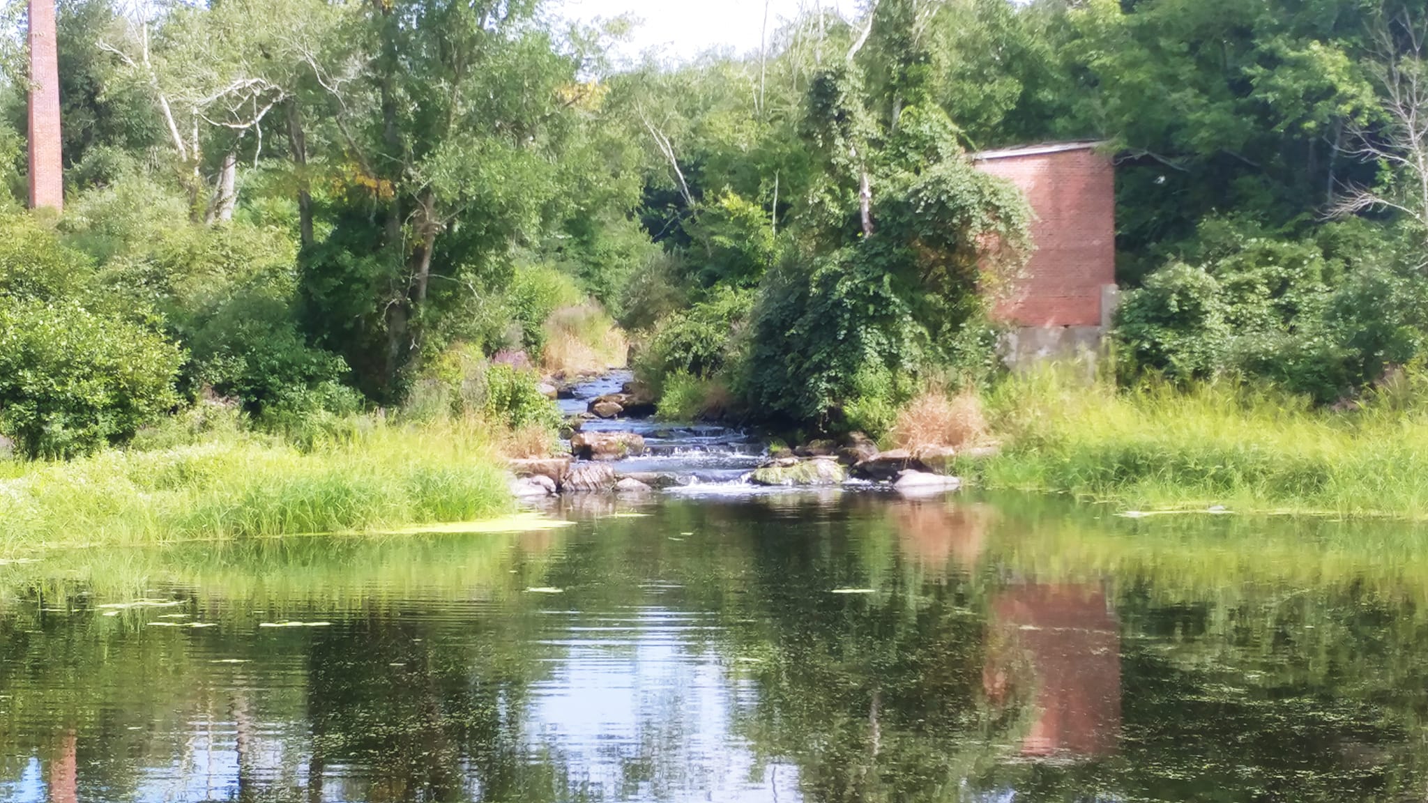
"The structures of Dean's Mill, where the upper dam is now, just north of I-95. 
About the only recognizable feature is the large stone hill at the right."

Image Credit: Grace Wheeler Old Homes In Stonington" p.34

On a separate page of the Quiambaug/Mistuxet Valley website, there is more information about Dean's Mills and the image of the mills (above): 

...[According to the image above] from Wheeler's "Old Homes in Stonington", pg 34; the house was built in 1700. The large rock on the right suggests this is near where the upper dam is now, just north of I-95.  The text of the book introduces this topic by mentioning the lane from the Stanton's house, which would place this at the upper dam.  After the I-95 construction and various rounds of repair to that dam, little is left to match against this image.

Then the webpage provides some more history about the Deans and their mill activities: 

...James Dean of Taunton came to Stonington, and his son James Jr. established a fulling mill:

James Dean, Jr., did not confine himself to blacksmithing, but learned the business of fulling and dressing woolen cloth, and for that purpose erected a fulling-mill on Mistuxet Brook, afterwards known as Dean's Brook, about one-third of the way from the old post road down to the Dean's Mills.  There he continued both branches of business until his son, John Dean, reached manhood, when he and his father built a new dam and erected another fulling-mill near his dwelling-house, where the dam now crosses the brook.  After this arrangement was effected they devoted their time and attention to cloth-dressing, wool carding, and for the manufacture of cotton and woolen goods were obtained... James Dean continued in business until 1830, when he retired.

...The "old post road" we now call Pequot Trail, and "Dean's Mills" is, as described above, at the "upper dam" just north of I-95.  This places the original fulling mill 2/3 of the way between them.  Recently I received a number of photographs of this location, only possible because of an extensive drought...

I am not going to repost those photographs, which were taken of what was left of Copps Brook in 2016 during that year's drought, but these photos clearly show there is nothing left of the mill seat except piles of rocks, the ruins of what was once the upper dam before the highway was built. The foundations to the mills could not be located -- they are either buried under debris and sediment or they are long gone, torn up in the construction of Interstate 95.

And finally, here is where we came in. There on the Quiambaug/Mistuxet Valley website was the image from the postcard from the Facebook post, but this postcard's caption comes with a more accurate "near" address:

According to  the Quiambaug/Mistuxet Valley website, 

"the [p]recise location [of the glacial erratic pictured above] not known, but the large boulder may be the rock on the western side of the reservoir just north of the upper dam."

I plan to take a motorcycle ride over there in the near future and see if I can find the boulder in the postcard. Unfortunately, there is no point looking for the foundations Dean's Mill, as they were destroyed by the construction of Route 95. My guess earlier in this quest, that something should still be there unless it was "blasted out" to build a road was not far off the mark. But while I'm there I will take a stroll along the Deans Mill Preserve, which may the closest thing we have to going to Dean's Mill Park in the 21st century.

________________________________________________

[1] Grace Denison Wheeler, "Old Homes In Stonington" 1903 (reprinted 1930), The Mystic Standard.  Available from the Stonington Historical Society (Higginson Book Company reprint)

[2] Bryan A. Bentz, The Quiambaug/Mistuxet Valley A History of a Valley and its Two Ridges. https://qb.mindhenge.org

Wednesday, August 24, 2022

Sunday, August 21, 2022

Three weeks into August...


So once again we've just about frittered away yet another perfectly good summer.


-- "What about existential dread? Can that be a hobby?"

Saturday, August 20, 2022

Currently Reading Christian McBurney's Dark Voyage: An American Privateer's War on Britain's African Slave Trade

I finally made the trek to Wakefield Books in my car -- I have been in in Wakefield several times recently on the Grom, but without saddlebags it's a bit dicey carrying much in the netting on the passenger section of the seat. 

And its been too hot to ride around with a backpack on. 

Skip to the end -- I walked up to the History section and there in the middle of the display...

I had just finished re-reading all of The Expanse novels when I heard that Chris McBurney's most recent book was a study of the destructive effects of Rhode Island privateers upon Britain's slave trade during the Revolutionary War. I decided to check it out, as it might inform parts of the Rhode Island History course I am proposing. So far I am four chapters in, and there definitely are details that will broaden the depth of those parts of the course examining the American Revolution, slavery, and BIPOC populations.

Fresh out of the bag

Once I have finished reading Dark Voyage, I will review it on Amazon and also post my thoughts here on the blog.

This is the promo for Dark Voyage in Christian's latest email:

My new book is called Dark Voyage: An American Privateer's War Against Britain's African Slave Trade. The privateer was constructed from and departed Providence in 1778, during the American Revolutionary War. Its officers and crew hailed mostly from North Kingstown, Exeter and South Kingstown. This privateer sailed to West Africa and inflicted more damage against Britain's slave trading forts and ships than any privateer during the war. It is a remarkable story, never before told.

We should all support Rhode Island’s wonderful independent bookstores and historical society gift shops! Currently, their price for Dark Voyage is no higher than amazon.com’s ($35).  These outlets have Dark Voyage in stock:

  • Wakefield Books, Wakefield Mall (many copies in stock and best price)
  • Charter Books, Newport, 8 Broadway (just north of the Old State House; it is a wonderful, bright, new bookstore) (book signing on August 9, at 6 pm!) 
  • Commonwealth Books, Newport, 29 Touro Street
  • Barrington Books, Barrington, 184 County Road
  • Newport Historical Society Gift Shop, Newport, 127 Thames Street (Brick Market building)
  • Island Books, Middletown, Wyatt Square, 575 E. Main Road
  • Books on the Square, Providence, 471 Angell Street
  • Stillwater Books, Pawtucket, 175 Main Street
  • Island Bound Bookstore, Block Island, Water Street
  • Block Island Historical Society Museum Shop, 18 Old Town Road
  • Rhode Island Publications Society at https://ripublications.org/rips-store/ 

(Most of the above stores also carry my books The Rhode Island Campaign: The First French and American Operation in the Revolutionary War and Spies in Revolutionary Rhode Island.)

To purchase the book online at amazon.com, click here.

You can also purchase from the publisher’s website.

If you do purchase Dark Voyage, it would be greatly appreciated if you could complete a review of it on amazon.com. Such reviews are particularly helpful to authors who do not have big New York or London publishers behind them.

Thank you for being a reader and supporter of smallstatebighistory.com.

Be safe this weekend!

Christian McBurney

Editor and Publisher, The Online Review of Rhode Island History

___________________________________________________

Remember -- and NEVER FORGET


Friday, August 19, 2022

The Battle of Shannock Falls

Wednesday I was driving to the opening day of the Washington County Fair in Richmond, coming from Wakefield Books and Hera Gallery in South Kingstown. Rather than battle the congestion of summer traffic on Route One, I took Worden's Pond Road and wended my way through the mill village of Shannock. 

I stopped for a few minutes to take photos of this monument.


These are the falls the battle was fought over:


Textile manufacturer John Knowles built a mill here circa 1834 and constructed a dam here sometime in the 1830s or 1840s, according to the NRHP nomination form for Shannock Village. The dam was removed in 2010, according to the historic signage for this area of the historic district (image below):


Map of the Shannock Historic District, RIHPHC 1983.
The location of the monument is the red dot, beside the bridge
on Shannock Road over the Pawcatuck River. The falls are labeled 52,
and the ruins of the power building are labeled 53.

Not that I doubt there was a battle here -- it makes sense that this region in general and these fishing grounds in particular would be a contested frontier between the Pequot and Narragansett -- but other than there was a battle, there are no other details about it. This short blurb from the 1981 RIHPHC survey of Charlestown is typical of all the secondary accounts I've read about it:

"The Narragansetts and Pequots were rivals and they repeatedly fought for local dominance in Niantic territory. Their most famous battle occurred at Shannock Falls. Here, the Narragansetts successfully defended the important fishing rights which they controlled" (Charlestown, 6)

A similar snippet is found in the 1937 report of the Rhode Island Tercentenary Commission for a site the Commission called "Shannock Hill" (which is actually located a mile or so north of the falls and the site of the battle; see map below). The Tercentenary Commission were responsible for erecting the monument, in celebration of the 300th anniversary of Rhode Island's founding.

"Here the Narragansetts won a fierce battle against the Pequots for control of the fishing falls. A wooden marker was placed by Rhode Island Historical Society June 1897 on the 250th Anniversary of the Death of Canonicus." 

Topographic map of Shannock Hill (elevation 269 feet at red marker), in relation
to the
 Shannock Village Historic District and Shannock Falls (inside rectangle)
at the foot of the hill.

The latter account does provide more information about the history of the monument, but nothing more about the battle itself. It's possible there are narratives nearer to the time of the actual battle -- Roger Williams did spend quality time with his friend, Narragansett leader Canonicus, in the 1630s and 1640s before the sachem's death in 1647. Williams may have recorded something Canonicus told him about this event, but I have yet to find anything attributed to him about it. (Yeah, me -- yet another good argument for picking up the seven-volume set of  The Complete Writings of Roger Williams...scanning it, OCR'ing it and making all 3,052 pages keyword searchable.) If the battle took place after 1580, Canonicus likely fought in it and if he did not, he would have been able to provide a narrative of the conflict considerably longer than two sentences I've been able to find.

But just as likely there is no greater account of the Battle of Shannock Falls in Roger William's surviving papers, because there is exactly zero mention of it in Elisha R. Potter Jr.'s 1835 account, The Early History of Narragansett. Like most antiquarian historians, Potter's narrative relies on -- in his words -- "printed or manuscript works of writers living at the same time with, or soon after the events they describe; the records of the state and towns; and tradition." While he offers little information beyond simply re-writing what he read, with little to no interpretation of events, had he encountered the details of the Battle of Shannock Falls he doubtlessly would have included them. 

This is what Elisha R. Potter Jr. wrote about the Pequots, Narragansetts, and their boundary disputes:

Roger Williams says the Indians were very particular in the boundaries between different tribes: " The natives are very exact and punctual in the bounds of their lands, belonging to this or that Prince or People, (even to a River. Brooke.) &c... (Potter, footnote on xi)

The Narragansett Tribe, occupied the whole of the present county of Washington, excepting the country between Pawcatuck river and Wekapaug [sic], the possession of which appears to have been a frequent subject of contention between them and their western neighbors the Pequots. The Narragansetts, however, appear to have taken final and quiet possession of this disputed tract, alter the destruction of the Pequots, in 1637... (Potter 1)

...[John] Winthrop mentions that there was a quarrel between [the two tribes] this year, (1634,) and that the Pequots endeavored to obtain the assistance of the English, "because they were at war with the Narragansetts..." (Potter 17)

The Pequots had, according to some accounts, pushed their conquests into the Narragansett country, as far East as Wecapaug Brook; and these two tribes were always at variance (Potter 23)

While it is possible the Battle of Shannock Falls took place in 1634 as part of this conflict between the two tribes, Potter's account includes no actual details about the Pequot's quarrel was with the Narragansetts or where any actual fighting took place. The only location Potter references is Weekapaug, Niantic territory along the coast in present-day Westerly, a good 15 miles to the south and east of Shannock. It is a better argument based on the evidence that the conflict in 1634 was over which tribe maintained hegemony over the Western Niantics along the coast rather than inland fishing rights on the Pawcatuck River in Charlestown and Richmond. It is not possible to connect anything Potter reports to the battle in Shannock.

Based on the evidence at hand, the story of the battle began as Narragansett oral tradition that was passed on to the English at some point after the "Vacant Lands" were sorted out, and after the location for the Narragansett reservation was established in 1709, in what later became the town of Charlestown in 1738. That it is based on a tradition passed on by white settlers explain why there are no other details that accompany the story. 

I have a theory (absolutely unprovable), about the origins of the story, since it doesn't appear in early written accounts. Early white settlers in Charlestown would have purchased lumber from the so-called Indian Saw Mill, which operated from c. 1700 to 1900 on Old Mill Road. The saw mill is in the heartland of the region that the colony of Rhode Island reserved for the Narragansett. The ruins of the saw mill are only about a mile and half miles south of Shannock Falls, not far from Narragansett Trail.

The remains of the Indian Saw Mill, located on Saw Mill Pond
off of Old Mill Road, Charlestown RI

The Indigenous operators of the saw mill told the story of the battle to their white customers in the early 1700s. The story about the battle at the falls continued to be passed down by word of mouth among white Rhode Islanders, until the first marker was finally erected in the late 1800s. There is evidence of similar local "folk traditions" passed on among Charlestown's white inhabitants. The saw mill was certainly a point of contact between Charlestown's white and Indigenous societies, and perhaps it took on a similar role to that of the local barbershop, passing on tales of local events between its operators and customers.

If I do discover any more evidence beyond "there was a battle here," I will update this post.

______________________________________________

Christensen, Robert O., Shannock Village Historical District. National Register of Historic Places Inventory - Nomination Form, June 1983.  https://preservation.ri.gov/sites/g/files/xkgbur406/files/pdfs_zips_downloads/national_pdfs/charlestown/char_shannock-village-hd.pdf 

Davis, Jack L., "Roger Williams among the Narragansett Indians," The New England Quarterly, Vol. 43, No. 4 (Dec., 1970), pp. 593-604. https://www.jstor.org/stable/363134

Nebiker, Walter, Historic and Architectural Resources of Charlestown, Rhode Island: A Preliminary Report. Rhode Island Historic Preservation and Heritage Commission, June 1981.  https://preservation.ri.gov/sites/g/files/xkgbur406/files/pdfs_zips_downloads/survey_pdfs/charlestown.pdf

Potter, Elisha R. The Early History of Narragansett: With an Appendix of Original Documents, Many of which are Now for the First Time Published. Providence, Marshall, Brown and Company, 1835.  https://www.google.com/books/edition/The_Early_History_of_Narragansett/gjazs0_D9owC?hl=en

Rhode Island tercentenary, 1636-1936. A report by the Rhode Island Tercentenary commission of the celebration of the three-hundredth anniversary of the settlement of the state of Rhode Island and Providence Plantations, Rhode Island Tercentenary Commission. Providence, 1937.  https://babel.hathitrust.org/cgi/pt?id=hvd.hxta8y&view=1up&seq=165&skin=2021&q1=Shannock

All photos and images by the author unless otherwise noted.

Monday, August 1, 2022