Monday, July 29, 2013

Digging Up The Past: The Mystery of the Lost Filling Station

July 2, 2013 I was driving up Route 3, also known as Nooseneck Hill Road, in West Greenwich. As I was coming down the hill just before the bridge over the Big River I noticed a swarm of trucks and workers in fluorescent vests over on the left, where an old road that I had always assumed to be old Nooseneck Road comes out onto the main road (below). As I drove past, an excavator was pulling a huge old underground gasoline tank out of the ground. As long as I have known, there was never a gas station there, not even the hint of one. A piece of history – and a mystery! I immediately turned my car around and walked over. I introduced myself and struck up a conversation with an engineer from Resource Controls who was taking samples to check
for possible soil contamination. He said there had once been a gas station there, but that he had no idea what the station was or when it was in business. A worker from Western Oil Company joined our discussion. He said that earlier in the day there were town workers at the work site, and one of them told him that he had been in town since 1977, and as far back as he knew there was never any building on the site or evidence of a gas station. Based on the size of the tank, he doubted that it had been a little “mom and pop” station and estimated that the tank was anywhere from fifty to seventy years old. The engineer from Resource Controls suggested that the station went out of business when Route 95 came through, in a plot turn similar to that of the Disney Pixar film Cars. I mentioned that there was also a possibility the station was condemned as part of the Big River Reservoir project, but the engineer shook his head; he thought the gas station was probably gone before then.

While we were talking, the Western Oil Company excavator carried the empty gas tank and placed it on a large flatbed trailer; it was about to be hauled away by dump truck to Exeter Scrap Metal. I went home to get my camera, but the truck had already left by the time I got back. I followed the old tank to Exeter Scrap Metal, which recently moved a quarter-mile north of their old location, with a green metal scorpion out front that should give the “Big Blue Bug” in Providence a run for its money (above). The scrap yard folks were kind enough to let me photograph the old gasoline tank in its new digs (below, tank circled).


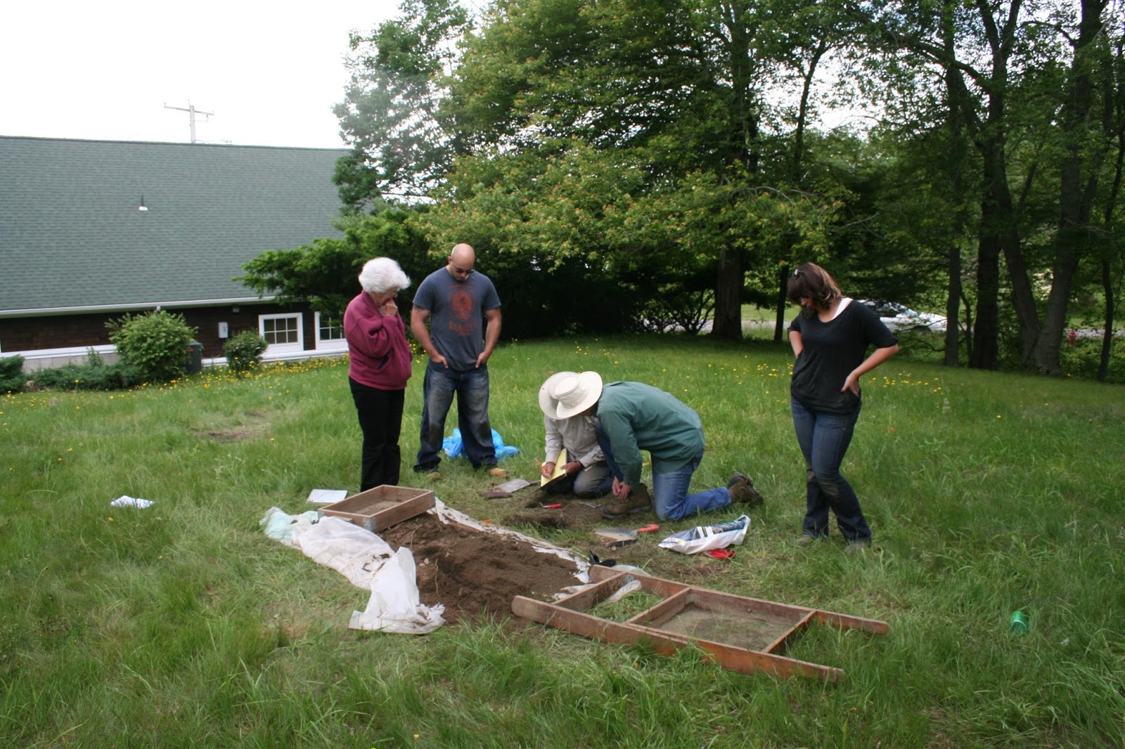
When I came back to the excavation site, the engineer from Resource Controls was discussing his soil samples with Angela Harvey, an engineer from DEM. She introduced herself to me and I told her I was from WRICHS with a historical interest in the business that had once been located there. She mentioned that the road we were standing next to was actually not an older section of Route 3, but rather was once known as Kitts Corner Road (left). When I asked Ms. Harvey about the former proprietors, like everyone I had spoken with she did not know who had operated the station or when it went out of business.

Then I mentioned that it may be possible that RIDOT’s bridge authority, which has an extensive photographic archive documenting state bridge-building for over a century, would have documented the construction of the nearby bridge over the Big River (this RIDOT photo archive was one the topics covered in “Over the River and Through the Woods: Bridges, Highways, and Public Works,” a workshop put on at the recent Rhode Island Preservation Conference in West Warwick in April 2013). Though the ceramic name and date tiles are no longer extant on the bridge (in fact, the bridge seems to be deteriorating rather badly at this point), it was almost certainly built in the latter 1930s during the Great Depression as part of the WPA. Maybe the bridge-building photos captured, off in the distance, an image of the gas station.

At that point Ms. Harvey told me about a historical resource I was not aware of. DEM has an extensive archive of aerial photographs of the entire state that date back to 1939, catalogued online using a GIS (Geographic Information System) program. I gave her my card and she agreed to send me information pointing me to DEM’s aerial photograph site. As promised, the next day she sent me a link to http://www.dem.ri.gov/maps. Her email instructed me to

“[s]imply scroll down to the fourth map selection (Topo Map & Aerial Photo Viewer), which will take you into the GIS program. Once you enter the viewer, type your address into the “find places” space located at the top right corner of the screen.”


I was able to navigate the map to the gas station locale simply by zooming in with my mouse wheel. On the upper left menu, by clicking the > symbol, the layers of the GIS map appear as a list. The default map that first appears is the “2011 Color” aerial map of Rhode Island; when the menu boxes for earlier maps are checked, the more recent map will gradually be replaced by the earliest map checked.

These aerial maps are a very intriguing resource. I have spent some time of late exploring the transformation of different parts of the state. Is some places, fields have turned into forest, while in many others the forest has been converted into houses and shopping centers. I recommend everyone go there and look at how much your neighborhood or other familiar locales have changed over the past 70 years.


These maps help answer some but not all of the questions regarding the gas station on Route 3. The journey back in time starts with DEM’s default map from 2011 – the area where the gas station was once located is circled. With the next image, we go back to 72 years, to 1939. Route 95 disappears, along with Big River Road, the road running parallel to 95 South on the 2011 map. Further to the west, Weaver Hill Road met directly with Kitts Corner Road to connect the hinterland with Nooseneck Hill Road. Focusing in on that triangular intersection, it appears to be heavily wooded – there is no gas station there or any other business, just woods – in 1939. A house can be seen in the photo in the cleared lot due west of the wooded triangle. Today, the lot is empty but still there is still a stone retaining wall running parallel with Route 3 where the house once stood.


The next set of aerial maps is from 1951. In this image, the gas station appears as a large square building casting its shadow to the north, in the triangle at the intersection of Nooseneck and Kitts Corner, about the same size as the house to west behind the retaining wall. Zooming out on the website map, it is clear that for many people living in the hinterland of West Greenwich, the best road out to Route 3 north was Kitts Corner Road. This gas station was likely the first one folks from the hinterland would pass on their way to work in the morning and last one they would go by on their way home. What about the residents of the house next to the station? Were they the proprietors of the station? Or did they lease or sell the triangle lot to a local mechanic or a franchise? There is no way to identify any details about the business from this image. Based on the size of the building, the station quite probably had a service bay to provide auto repairs; most gas stations at that time did that along with selling fuel, unlike today’s gas stations that only sell gas. Since the station was not in the 1939 aerial photographs, and due to gas rationing during World War II, it is also a safe bet to guess that the station was built sometime between 1945 and 1951. The business relied on travelers from Kitts Corner Road heading out to Route 3, which was at that time the main road through western Rhode Island to get to Providence, and to provide auto repairs to folks that might have broken down along Route 3. This probable construction date of after the war would also make it unlikely that any of RIDOT’s Depression-era photos of the construction of the Big River Bridge would incidentally show us more detailed images of the service station than the DEM aerial photographs.


In the aerial images from 1962, the arrival of Route 95 makes a profound change on the landscape. Kitts Corner Road, like many local roads and farms along the path of the interstate, is cut in two. The gas station building is still there, though it is impossible to tell from the photo whether it is still in operation. Further south outside the frame of the above photo, Route 3 and Route 95 become one for the next several miles south. In the next image ten years later (below), the gas station is clearly no longer in existence, though the outline of the parking lot is much clearer than in earlier images. The house in the lot due west of the former gas station is still there, though whether anyone was living there still is impossible to determine. Further south, Route Three and Route 95 were also separated out and ran parallel to each other rather than being combined together. As a commuter who uses Route 95 southbound to get to work, I can speak to the importance of having a second, parallel route to take when an accident has closed the interstate and the highway is backed up for miles.


By 1972, according to the April 2013 RIHPHC workshop, Route 95 had become a limited access highway; a bridge now carried the interstate over Weaver Hill Road, which became the new access point for the West Greenwich hinterland to reach Route 3, and access to 95 from Kitts Corner Road was closed off. As a youngster, I remember my father being able to get on and off the interstate at Switch Road in Richmond, but that at some point the state put up guardrails and berms to prevent people from getting on and off the highway from any of the old roads that once crossed Route 95. The only way to access the highway was at the numbered exits with on and off ramps. To this day, my father (who turned 88 back in March) still argues that Route 95 “ruined the area” by making it difficult for people in the vicinity of the highway to get around their own neighborhoods. But in the early 21st century, with the tremendous amount of infrastructure and bridge repair that needs to take place, we are probably fortunate that every minor laneway in use one hundred years ago was not given a bridge to go under or over the path of Route 95.


So the mystery remains. Who owned this gas station? Did the business fall prey of Route 95 and the attendant decline of traffic on Route 3 as a result of the people using the interstate to get to Providence? With far fewer cars going by on Nooseneck Road and none at all coming down Kitts Corner, this intersection was certainly no longer the “central place” it once was and may have lost its economic viability. But there is another possibility: the Big River Reservoir. The state first began consideration of damming the Big River to create another vast public water supply like the one in Scituate as far back as the 1920s. In the 1960s, at exactly the same time that the federal government was finishing the interstate highway system, Rhode Island began moving ahead with another major engineering project right in the same area as our mystery gas station.

“In 1964, the General Assembly, under the Big River-Wood River Acquisition Act, established a requirement for a bond issue of five million dollars…to be placed on the general referendum ballot. Having recently experienced the inconveniences and health hazard associated with several drought seasons, the voters passed the bond referendum. Under the powers of eminent domain, the state began acquiring property by condemnation beginning in Coventry in 1965, West Greenwich in 1966, and the in the Wood River area in Exeter in 1967…In the end, the state obtained a total of 8,600 acres from 351 owners which comprised 444 parcels at a cost of $7.5 million…”

--Excerpt from RI WATER RESOURCES BOARD,
BIG RIVER MANAGEMENT AREA POLICIES, July 1997


Without more information from either a WRICHS member that might remember this business, or a trip to the West Greenwich town clerk’s office to review the land evidence records, it is impossible to know whether the gas station closed in the early 1960s due to the changes in traffic flow because of Route 95 or in the later 1960s by eminent domain for the Big River Reservoir.

Either way, it seems that this gas station was not destined to remain in business into the 1970s. Today, Kitts Corner Road is just one of thousands of old back roads across the US impacted by directly or indirectly by the arrival of the interstate – once economically vital thoroughfares that are now bucolic roads to nowhere (below).

_________________________________________


NB: A version of this blog post also appears as a two-part article in the July and September bulletins of the Western Rhode Island Civic Historical Society, The Hinterlander.

Tuesday, July 2, 2013

Digging Up The Past: Archaeology at the Old Quaker Meetinghouse

This past June archaeology students from the Anthropology Department at Rhode Island College led by Dr. Pierre Morenon, undertook a study of the site of the former South Kingstown Society of Friends Meeting House and the adjacent Quaker Burial Ground. Sandwiched a bit uncomfortably between the ramp for the Wakefield exit for Route 1 South, the Southern Rhode Island Chamber of Commerce, the property is in the custody and care of the Pettaquamscutt Historical Society. The only remaining part of the site that is visible today is South Kingstown Historical Cemetery #90, the actual Quaker burial ground; above the surface there is nothing left of the old meeting house.

Inscriptions on graves in the burial ground next to the site of the meeting house date between 1714 to 1870. The site has a written history and provides archaeological evidence that dates back to at least the seventeenth century and likely before that. Less than a mile from here is the remains of a major Narragansett Indian town known as RI 110. While the town was likely abandoned in the wake of King Phillip's War (1675-6) if not earlier, certainly Native peoples traveled over and hunted on nearby site of the Quaker Meeting House before and after the Pettaquamscutt Purchase of 1657/8, and Narragansett people remained in the vicinity in the wake of the war. Quartz stone flakes found in the course of the June 2013 excavation by the RIC archaeologists offer clear evidence of the pre-European provenance of the site.

After the war, the settlement of Pettaquamscutt was rebuilt and English settlement of the region long-known as the "Narragansett Country" began with renewed vigor. Colonial English records indicate that in 1696, Nathaniel Niles bought a part of the Pettaquamscutt Purchase known as the “mill estate” for the sum of ₤200, which included most of the land that is today the village known as Wakefield, which has become the largest commercial center in South County. Based on the name of the purchase, apparently some kind of mill activity was already taking place along the Saugatucket River before Niles made his purchase, likely somewhere between the former textile mills on Main Street near the present day Saugatucket Bridge and Wakefield Elementary School on High Street, though no specific records of this earlier activity exists today. The Niles estate appeared in the 1703 survey of the King's Highway, which is today the Old Post Road or Scenic 1A.

Today Route 1 bypasses this compact area of Wakefield, where in the late seventeenth century and early eighteenth century, the King’s Highway wended down Sugarloaf Hill to end at the western bank of the Saugatucket River. There is no evidence there was bridge over the river at that early date, and travelers forded the usually shallow waters and picked up the road on the far bank. In 1698, about a mile away to the east of the ford Nathaniel Niles donated land for a meetinghouse for the Society of Friends. The meetinghouse was completed around 1700, and by 1710 the local Kingstown meeting was associated with local meetings in Providence, Cranston and Warwick via the monthly Quaker meeting in (East) Greenwich (see Map 1).

Beginning in 1743, the South Kingstown meeting house began hosting its own monthly meeting, and eventually came to be associated with local meetings in Richmond, Hopkinton and Westerly. The original meeting house was used by the local Society of Friends until fire destroyed the original meetinghouse for the Society of Friends in 1790; local Quakers met in the private homes of Benjamin Rodman and “Nailer Tom” Hazard until the meetinghouse was rebuilt in 1795.

In 1845, a schism emerged in the New England Society of Friends "between followers of Joseph John Gurney of England, who favored a more evangelical and pastoral route, and followers of John Wilbur of Hopkinton, R.I., who preferred a simpler unprogrammed form of worship." Despite calls for simplicity, the Quaker community had grown much larger over the course of two religious awakenings and the South Kingstown meeting became the monthly meeting site for Westerly, Richmond and Hopkinton meetings, while the number of Quaker meetings in Rhode Island had increased from 10 meetings in the early 18th century to 21 meetings by the 1830s (see Map 2).

The South Kingstown was a Wilburite meeting, and continued to meet at the same location in their rebuilt meeting house until the last quarter of the 19th century when the Quakers built a new meetinghouse about a mile away on Columbia Street and abandoned the site both for their meetings and as a burial ground.

The investigation by the RIC archaeologists sought to answer several questions about the both the meeting house to the west of the stonewall on the site and the cemetery, which lies to the east of the stone wall. The gravesites were mapped out and the distance between headstones and footstones were carefully measured. In this way, graves of children could be identified to help provide more data for infant and childhood mortality among this population, while for adults, ranges and averages for height could be determined. Test pits dug at regular intervals in the grassy area west of the stone wall located the site of the original meeting house that burned down in 1790; debris, broken window glass and 18th century nails helped identify the footprint of the Quaker hall, while further to the west quartz flakes found in the test pits suggest that Native Americans had touched up some stone tools in that same location. Another question still left to be answered is whether the stone wall was contemporaneous with the original meeting house. If it was, then test pits dug immediately to the east to the wall should be able to answer that question. If there is no debris from the fire, then the wall was there and retained the debris; if there is debris, then it is quite probable that the wall was built after the fire occurred.


This summer and fall, the archaeologists will continue to analyze the materials collected in their lab, where I hope to visit and follow-up on this investigation. Eventually, the report of the excavation will be given to the Pettaquamscutt Historical Society, and most of the artifacts (e.g., nails, glass, and other rubble) will be reburied on the site.


____________________________________________


Sources:

"Wakefield" in Lost South Kingstown: With a History of Ten of Its Early Villages. Kathleen Bossy and Mary Kean (editors), Kingston: Pettaquamscutt Historical Society, 2004.

Friends Meetings in New England, 1710. Guide to the Records of the Religious Society of Friends (Quakers) in New England) compiled by Richard D. Stattler New England Yearly Meeting Archivist, Published by the Rhode Island Historical Society, 1997, page 12.

Friends Meetings in New England, 1833. Guide to the Records of the Religious Society of Friends (Quakers) in New England) compiled by Richard D. Stattler New England Yearly Meeting Archivist, Published by the Rhode Island Historical Society, 1997, page 13.

The Dead Come To Life A glimpse into what lies beneath South Kingstown's Historical Cemeteries. http://narragansett.patch.com/groups/around-town/p/the-dead-come-to-life.

Saturday, March 9, 2013

Oral History Projects in the Works

I have been increasingly drawn of late into the realm of oral history. My understanding of this particular branch of the great tree of history was, until recently I should admit, fairly simplistic, and based around the fact that from being a child my father recounted to me often tales of past things and events in our neighborhood. Born in 1925 he grew up in a rural farming society not too far different from the farm life of 1875 or in many ways even 1825 – the local shoddy mill manufacturing textiles, the one-room schoolhouse, the pump-handle well and the outhouse, horses not for dressage but for a transportation and to pull farm machinery – I think he was really struck by how much things had changed. He would recall for me the arrival of the first electric lights to the neighborhood; driving on the first tarmac road in the area down by the old Charlestown Naval Air Station; “riding the rails” of the Wood River Branch Railroad to the village of Hope Valley. By the time I came along in the mid-sixties, the vestiges of this old rural way of life were still present but were fading. The thing I remember most about it was the constant interaction with our handful of neighbors in a variety of farm projects that seemed to me never-ending. But by the time I was finishing high school that way of life was ending. Between the dying-off of the local neighborhood patriarchs and the building boom of the 1980s that saw land values skyrocket – land that I remember selling for a few hundred dollars an acre (and was rarely purchased) now sold for tens of thousands of dollars – the ways of the old neighborhood disappeared. Neighbors grew far too numerous to keep track of, and most of them didn’t care to wave back or stop their cars and chat anyway. During the 1980s and ‘90s I often thought I should make a project of photographing all the old barns in South County as they fell increasingly into disrepair and began to collapse upon themselves. At the time, my father (pictured below, at age 78) could recount who had once owned each farm, what their barns were used for, whether he had ever any occasion to go there, and when and why the farm went out of business.


In hindsight, I wish now that I had methodically recorded more of my father’s tales of the early and mid-twentieth century when he (and I) were younger – he will be 88 in less than two weeks. I did videotape him talking to me about local mills, businesses and railroads a few years back. We explored several locales as he recounted the events at each, but the days of his clambering over stone walls or even taking a modest walk over slightly uneven ground are, unfortunately, behind him now. I still have the videotapes, but never thought to transcribe them or have him sign a release – we both figured that his agreement to participate and be recorded for the purposes of posterity implied his permission to be used by me as a historical source. But the problem is, as most readers will agree, that life is very busy. To make time for a 'low-priority' task (i.e., to sit down and record my father’s recollections of the past) has taken a back seat to more pressing matters of the everyday (i.e., teaching, taking courses for re-certification, several summers researching and then writing a master’s thesis, maintaining a household, becoming a husband and a parent) – somehow years pile up and a more thorough recording of the oral history of my father’s life will probably not get much further than what we have already managed to accomplish.


                             Grandpa with grandson Ian, c. 2002 -- both are about the same height now

Realization of this missed opportunity and a more recent encounter with the World War II Foundation has gotten me to reconsider the urgency of the oral history mission. Back in December, I went to a Teaching World War II workshop at the Rhode Island Historical Society called "D-Day: The Price of Freedom." The workshop, led by Tim Gray of the WWII Foundation, featured a video by the same name. During the introduction, Gray explained how he got involved in the project, and the importance of the work he is doing. Beginning with a trip to France that included a visit to Normandy’s American cemetery, Gray wondered how many Rhode Islanders had fought and died in the conflict (99 men are interred there, actually). Upon his return to the states, he began researching the answer to his questions, work that eventually led him to begin interviewing local veterans of the Normandy invasion. This effort culminated in the documentary movie D-Day: The Price of Freedom, where he filmed the return of several Rhode Island veterans to the beaches of Normandy sixty years after the invasion. He then explained why he founded the World War II Foundation as a result. The last American World War I veteran, Frank Buckles, died in 2011. In the past decade, over 1000 World War II veterans have died each day in the United States; in a few years they too, like the veterans of World War I, will be all gone. Gray has made it his mission to preserve as much of this living history as he possibly can in the time that is left. I have recently come across similar concerns about recording the stories of the women who helped build the American war machine that defeated Hitler, or who took part in the fight for contraceptives and birth control, or in the civil rights movement, or Vietnam protests…there seems to be a growing awareness that events that once seemed to be part of the recent past are quickly receding into “history,” a past that will soon be out of reach of the first-hand account and oral history.

As I started working in the Western Rhode Island Civic Historical Society Archive last summer, I first began thinking about establishing an oral history project there. Tim Gray’s project convinced me that there is a need for such work to be done, and I began in earnest to look into the logistics of putting together a Western Rhode Island Oral History Project. Last month I had the opportunity to visit an oral history project that has been in operation since the early 2000s - The Matunuck Oral History Project, which published its first volume of oral history in 2006. Sandy McCaw (a fellow traveler at the Pettaquamscutt Historical Society and volunteer coordinator of the Willow Dell Historical Society’s Matunuck Oral History Project) saw to it that I was invited to "A Celebration of the publication of Volume VI of the Willow Dell Historical Association's Matunuck Oral History Project." The celebration, held at the Matunuck Land Trust Barn, featured nostalgic reminisces by long-time Matunuck residents amidst concerns over properties lost to the recent hurricane and winter storm damage and erosion, as well as offering the latest volume of the Matunuck Oral History series. Volume IV, Matunuck: Not just a place but a state of mind gathers “fifteen interviews featuring the historic houses and special places of Matunuck.” The introduction is written by Barbara Hale Davis, and features oil paintings of Matunuck houses by Anna Richards Brewster, Frank Convers Mathewson, and her great-grandfather Edward Everett Hale. From there the project tells the highlights of a number of South Kingstown locales, such as Roy Carpenters Beach (as related by resident Kevin McCloskey) or Point Judith Pond (by URI oceanography professor Prentice Stout and hiswife Patricia). Replete with many color and black and white images, the interviews have all been transformed into narrative accounts. Much of the stories’ appeal would be of most interest to the local consumers of Matunuck history, but there is enough relevance made to the larger history of South Kingstown, Rhode Island, and the United States to make the book interesting to non-locals as well.


I also had been trying to get in touch with someone (anyone) at the New England Oral History Association (NEOHA), but I was not having any luck. On my most recent attempt I was redirected to the Oral History Office at the University of Connecticut. From there, I made contact with Bruce Stave, professor of history at UConn and director of the UConn Oral History Office. I made an appointment to see him, which as it turned out, was to take place only three days after the celebration at the Matunuck Oral History Project. Dr. Stave is a fellow resident of Coventry, but of the Connecticut variety. (Coincidently, Coventry CT was also the home of Nathan Hale, Revolutionary War hero and the grand-uncle of the aforementioned Edward Everett Hale.) My meeting with Dr. Stave was very informative. He first explained why I was getting nowhere with contacting NEOHA – the organization is currently defunct and on hiatus. He gave me a number of resources (many of which can be found on the Stave Group website and a list books to read. He explained that oral history is a process that goes beyond simply finding someone old and asking them questions. He insisted that the oral historian should always have a project or a goal around which they organize their research, base their questions, and identify persons to interview. At the first interview, the interviewee should always sign a “consent to be interviewed” form, and the recordings made become the property both of the interviewer and the interviewee, who should get a copy of them as well to do with as they wish. The interviewer should transcribe the interview, and when finished they should meet again with the interviewee, who is given a copy which they can edit for content. The final edited transcript is then signed off on with a second consent from. At that point, the transcript becomes a historical source document which can from the basis of projects like the Matunuck Oral History series.

Dr. Stave and I then discussed what might be a viable project for me to begin for the Western Rhode Island Oral History Project. I related that one of my tasks as the archivist of the WRICHS is to help organize the Society’s past records and help recover the “institutional memory” of the Western Rhode Island Civic Historical Society. He had mentioned that one of the projects he undertook at the UConn Oral History Office was to interview the staff and members of the Connecticut Historical Society to create an oral history of that society that served a similar purpose. Given that there are a number of people with long memories of the WRICHS both in the community and serving on the WRICHS board, I decided that would become our first project. I mentioned my idea for an oral history project at the Society’s most recent planning meeting, and got the go-ahead to start putting together a planning “mini-grant” from the Rhode Island Council of the Humanities, which also provides funding for the Matunuck Oral History Project. For the time being the mini-grant program is on a “spring hiatus,” which gives me some time to do some research into what sort of equipment I should budget for.

Building on that idea, I intend to reach out to other Rhode Island historical societies, house museums, and historic districts and suggest they too create an oral history of their own organization, that they keep a copy, and the WRICHS keep a copy, as per Stanford University’s LOCKSS Program (Lots Of Copies Keep Stuff Safe). As part of the planning grant, I want to put together an oral history workshop and invite Dr. Stave and his oral history team to come out and talk to all interested parties about how to set up an oral history program. Eventually, a history of Rhode Island’s historical organizations and preservation efforts could emerge from such an effort.


Dr. Stave also asked me if I have ever used oral history in my teaching. I haven't, but he suggested it might be another good place to start. As mentioned in a previous blog post, my history department is developing a new research paper for the US History II course based on the idea of America’s “Grand Expectations” after World War II. I brought up the idea of incorporating oral history into the student’s research project in a recent department common planning meeting, and my suggestion was met with some enthusiasm. Where there may be some students whose buy-in to the research paper would be somewhat muted despite being able to choose their own topic, those same students might be more interested if they could choose rather than conducting extensive library research, to instead interview a relative, neighbor, or other local resident about their knowledge of how the student’s chosen topic or event affected the interviewer. The work of identifying a candidate to speak with, developing good open-ended questions, interviewing and then generating a transcription certainly qualifies as a research project. The final transcripts could also be cataloged in the school library and serve as a source of information for future research papers.

Currently I am reading some of the books that Dr. Stave recommended – Valerie Raleigh Yow’s second edition of Recording Oral History: A Guide for the Humanities and Social Sciences (Walnut Creek: AltaMira Press, 2005) is an excellent how-to guide for designing interview questions, memory, recall, strategies for questioning, even words and phrasing to avoid when interviewing. Barbara W. Sommer and Mary Kay Quinlan’s The Oral History Manual (Walnut Creek: AltaMira Press, 2002) provides an overview of the entire project: project planning, recording technology, budgeting, interviewing, and processing and care of oral history materials. I also took out from the library the second edition of Donald A. Ritchie’s Doing Oral History: A Practical Guide (New York: Oxford University Press, 2003) covers much the same topics as the Ritchie book, but is longer and also has sections on teaching oral history and using oral history in the classroom. Before visiting Dr. Stave I had also taken out a copy of A Guide to Oral History and the Law by John A. Neuenschwander (New York: Oxford University Press, 2009), which had some interesting case studies related to the legal considerations of oral history. Neuenschwander’s book also discusses online use of oral history and includes legal release agreements. Dr. Stave agreed it was an interesting book but said I shouldn't be too concerned about potential lawsuits. My take-away is that as long as the work is ethical and honest, and the double consent procedure is followed, there really shouldn't be any problem.

Finally, I bough a copy of Linda P. Wood’s Oral History Projects in Your Classroom (Carlisle: Oral History Association, 2001). Linda Wood was at one time the librarian at South Kingstown High School, and organized several oral history projects. Among those include “The Whole World Was Watching: An oral history of 1968,” In the Wake of '38, and What did you do in the war, Grandma?: An oral history of Rhode Island Women during World War II. On the Prentice Hall/Pearson site, Linda Wood has written an online Guide to Using Oral History. Here is an excerpt of her pedagogy for using oral history in the classroom:

One of the most important lessons students can learn from oral history is to see that individuals are part of the greater society and that the individual is shaped by society and, in turn, helps to shape society. They get a snapshot of another person's life as he or she interacts with events outside that life, and, in doing so, they learn how the individual reacts to the events, learns from them, and attempts to exert control over them. In every interview in every oral history project, the narrators explain what they saw, what they did, and what they thought about the things they were experiencing. Students listen and learn from these interviews. They learn that history is assembled from these human pieces, that no one piece is any less important than any other piece, and that they have a role in making sure the pieces are not lost.

Saturday, January 26, 2013

The Eve of Destruction: How 1965 Transformed America

Thursday evening January 24, 2013, Brown University historian James Patterson gave a presentation at the Fabre Line Club (200 Allens Avenue) in Providence about the year 1965, and why it is so pivotal in understanding the transformative decade of the 1960s. The talk also happened to be the topic of his most recent book, The Eve of Destruction: How 1965 Transformed America. Dr. Patterson, Ford Foundation Professor of History Emeritus at Brown University, is also the author of volumes 10 and 11 in the Oxford History of the United States series -- Grand Expectations: The United States, 1945–1974 (published 1996), and Restless Giant: The United States from Watergate to Bush v. Gore (published 2005).

These well-received overviews of US history since WWII (Grand Expectations won a Bancroft Award in 1997) have made Patterson eminently qualified to speak on what he has identified as the "hinge year", the turning point where post-World War America shifted from the conformist “All-American” culture of the ‘Long 1950s’ (which began perhaps in 1945 with the end of WWII) to the explosive counterculture of the 1960s. While many commentators on the period tend to point to the assassination of JFK in November 1963 as the “end of innocence,” or the arrival of the Beatles in America in early 1964 as the crucial cultural turning point, Patterson argues that the real “sixties” doesn’t begin until 1965. The “decade approach” to American history works for some periods – the 1920s, the 1930s, and possibly the 1980s and 1990s tend to fall into ten year chunks, but the 1950s and 1960s are problematic in this regard. Patterson’s take is that 1965 is really the beginning of the 1960s that looms large in the public imagination – the protests, the violence, the Vietnam war, the counterculture, the music and Woodstock.

Patterson began his talk at the Fabre Line Club with the confession that he is not the first to describe 1965 as the “hinge” year of the 1960s. In 1995, the renowned conservative George Will had pointed out 1965 as a pivotal turning point in American history, not to mention the much-less regarded conservative, Newt Gingrich, has done so as well.

Patterson’s argument is that the triumph of liberalism was at hand in 1964. With his landslide victory over Barry Goldwater (486 to 52 in the Electoral College), and the domination of the Democratic Party in both houses of Congress, Johnson’s hubris brought him to make this almost surreal speech at the lighting of the national Christmas tree in December 1964:

…These are the most hopeful times in all the years since Christ was born in Bethlehem.

Our world is still troubled. Man is still afflicted by many worries and many woes.

Yet today--as never before--man has in his possession the capacities to end war arid preserve peace, to eradicate poverty and share abundance, to overcome the diseases that have afflicted the human race and permit all mankind to enjoy their promise in life on this earth.

At this Christmas season of 1964, we can think of broader and brighter horizons than any who have lived before these times. For there is rising in the sky of the age a new star--the star of peace.

By his inventions, man has made war unthinkable, now and forevermore. Man must, therefore, apply the same initiative, the same inventiveness, the same determined effort to make peace on earth eternal and meaningful for all mankind.

Grand expectations indeed. From there, Johnson, consummate master of Washington politics and Capitol Hill, took full advantage of his election mandate. LBJ’s Great Society picked up where FDR’s New Deal left off: Medicare, Medicaid, immigration reform, the Voting Rights act of 1965, the War on Poverty, the Education Act of 1965 – a stunning feat of serial legislative engineering that remains unparalleled to this day.

But at the Christmas tree lighting of 1965, Johnson did not follow up on his bombast from the year before as the liberal triumphant. What had humbled him? Patterson carefully expounded on the escalation of war in Vietnam, Selma, the rise of Black Power and the open fragmentation of the civil rights movement, the Watts riots which exploded only days after the passage of the Voting Rights Act, the first teach-ins, the rise of the SDS and resistance to the draft… all this violence and discontent turned the country almost on a dime.

The “grand expectations” of America were brought to heel in a flood of uncertainty that really began, Patterson convincingly argues, in 1965. The year began with the Beatles “I Feel Fine” as the number one song in America. But by late September, P.F. Sloan’s "Eve of Destruction" as sung by Barry McGuire was number one. Patterson then played a cassette tape (which is in itself an analog relic in this age of digital music) of McGuire’s hit song while the room quietly listened.

The eastern world it is explodin',
violence flarin', bullets loadin',
you're old enough to kill but not for votin',
you don't believe in war, what's that gun you're totin',
and even the Jordan river has bodies floatin',
but you tell me over and over and over again my friend,
ah, you don't believe we're on the eve of destruction.

Don't you understand, what I'm trying to say?
Can't you see the fears that I'm feeling today?
If the button is pushed, there's no running away,
There'll be no one to save with the world in a grave,
take a look around you, boy, it's bound to scare you, boy,
and you tell me over and over and over again my friend,
ah, you don't believe we're on the eve of destruction.

Yeah, my blood's so mad, feels like coagulatin',
I'm sittin' here, just contemplatin',
I can't twist the truth, it knows no regulation,
handful of Senators don't pass legislation,
and marches alone can't bring integration,
when human respect is disintegratin',
this whole crazy world is just too frustratin',
and you tell me over and over and over again my friend,
ah, you don't believe we're on the eve of destruction.

Think of all the hate there is in Red China
Then take a look around to Selma, Alabama!
Ah, you may leave here, for four days in space,
but when you return, it's the same old place,
the poundin' of the drums, the pride and disgrace,
you can bury your dead, but don't leave a trace,
hate your next-door-neighbor, but don't forget to say grace,
and you tell me over and over and over and over again my friend,
you don't believe we're on the eve of destruction.
no no you don't believe we're on the eve of destruction.

I have used this song myself in teaching the 1960s – musically the song is a brilliant piece of folk-mainstream crossover -- a pastiche of Dylanesque protest folk with its acoustic guitar, harmonica, nasally vocals and references to Vietnam, Selma, and nuclear annihilation. Ironically, by the time McGuire’s song had replaced the Beatle’s pot-addled “Help!” in September 1965 as the number one song in America, Bob Dylan was in the midst of rejecting his identity as the voice of the 60s folk generation, plugging in at Newport and returning to his rock’n’roll roots by going on tour with The Band…

The questions and answer session after Patterson’s talk was nearly as interesting as the talk itself. He pointed out as the Q&A began that it appeared everyone in the room had lived through the year. I looked around in agreement – I was probably the youngest in the room, so I can attest that he was correct. I have to admit though I was alive in 1965, I can’t say I remember anything about 1965. I know I turned one that year. I had not yet quite reached my six month birthday on December 18, 1964, the day that Johnson compared his administration to the birth of Christianity. It was very enlightening to listen to people whose memories of the year were considerably more detailed than mine. For the most part, audience members saw their experiences as a microcosm located on Patterson’s larger canvas. The most
remarkable exchange in the Q&A came when one gentleman, who had known Barry Goldwater personally, took exception to Patterson’s characterization of the Arizona senator as a deeply flawed candidate. Patterson listened politely then definitively tossed Goldwater back into the dustbin of history, pointing out the folly of Goldwater’s screed against the TVA in Tennessee, how his offhand remarks about nuking Vietnam and the Kremlin terrified millions and played right into Johnson’s hands, and the political suicide of calling for the abolition of Social Security while campaigning in Florida.

After the Q&A, I walked up to Dr. Patterson and introduced myself. We spoke about P.F. Sloan’s song and how emblematic it is as a cultural touchstone for this shift in the 1960s. I also explained to him that the history department where I teach has decided to use his Grand Expectations: The United States, 1945–1974, as the thematic source for teaching this period of American history, as well as a basis for students’ research papers. He was genuinely pleased to hear a high school program was using his book, and asked me to let him know how it turned out. But like 1965, we will have to live through 2013 before we can evaluate its success.

For those who were not able to catch James Patterson’s talk at the Fabre Line Club on The Eve of Destruction: How 1965 Transformed America, David Scharfenberg conducted a short interview with James Patterson in the Providence Phoenix in December 2012. Patterson also appeared on BookTV’s After Words, an hour-long program recorded in November 2012, where Professor Daryl Scott and Patterson explore in depth many of the themes only briefly touched upon herein. Both are recommended followups to this essay.

____________________________________________________________________ Sources

James T. Patterson, The Eve of Destruction: How 1965 Transformed America. New York: Basic Books, 2012.

-- Grand Expectations: The United States, 1945-1974. New York: Oxford University Press, 1996.

Lyndon B. Johnson: "Remarks at the Lighting of the Nation's Christmas Tree.," December 18, 1964. Online by Gerhard Peters and John T. Woolley, The American Presidency Project. http://www.presidency.ucsb.edu/ws/?pid=26766.

P.F. Sloan, Eve of Destruction Recorded by Barry McGuire, © 1965 MCA Records Inc. Lyrics transcribed by Manfred Helfert

Saturday, January 12, 2013

Adventures in Archiving: Work Spaces and Public Places

After recommending to the board of the Western Rhode Island Civic Historical Society that we should establish both a work space to process the manuscript collection, and a place
for the public to be able to sit down, access and use the collection, I am happy to report that my recommendations were accepted and work has begun to create such a space.

One of the problems I began to run into this past fall was that the work space I was utilizing was only temporary (see photo left). I was setting up in the "military room" (so-called because of the civil war uniforms, swords, and other military memorabilia on display) which was open to public tours. I could not simply leave folding tables and chairs in the middle of the room with whatever papers and manuscripts I might be processing laying about.

So there was a set-up and break-down process every time I came to work on the collection of about 30-40 minutes in toto. This meant that if I had a free hour where I could go work on the collection, most of that time would be spent simply carrying everything out of the library room, then putting it all back into storage a few minutes later (see photo right).

My recommendation to the September 2012 board meeting was to convert the military room to a work space that would be closed to the public, but that idea was voted down because closing it off would interrupt the flow of traffic on museum tours, which is circular and does not require visitors to retrace their path through rooms they have already visited. It was then suggested to me that part of the "music room" (so-called because of the nineteenth-century musical instruments and players on display, such as this Edison music player, below) be turned
over for a permanent work-space that would not have to be broken down every time I worked on the archive. One issue I realized as I considered that plan was the lack of light control -- the room's windows face south and west and the space receives direct sunlight for the afternoon hours; at the least new blinds and lighting would have to be purchased and installed. That could get expensive.

As I began to think more about the future of this project and not just my immediate needs in processing the collection, I realized that the Society should also have a place where the public can come in, sit down, and use the collection. This public access area should provide for some supervision of public usage -- a desk where someone from the WRICHS can comfortably watch people using the collection to ensure its safe handling and security, but also be where an archivist can work, answer questions, pull records out of storage and return them. I went back to the board with the suggestion that the military room be re-purposed into a work-space that would remain open to public tours; guides would simply inform visitors not to disturb the work in progress. Then the room would be re-purposed again into a public access space once the work on cataloging and arranging was complete.
The other advantage is that the windows in the military room face north, so direct sunlight is not an issue. I went back to the board with my ideas and a floor plan schematic (right).

The response was that the military room would be too small a space; that the public reading table/work space would take up too much room and it would be a cramped area for people to work in or tour through. This a valid point (see the first photo above). But providing public access to the collection is fundamental to the mission of the Society, and therefore it was decided that the music room should be entirely re-purposed into a permanent work-space now, that will become the public access room later. With light-blocking window shades, sunlight can be controlled and artificial lighting installed that would not damage the collection. I drew up a new floor plan (below), which has become the blueprint for what is now the WRICHS Archive Cataloging, Conservation and Public Access Project, and the board pledged funds for the project that hopefully can be matched by philanthropic grants. The essential plan is to catalog and arrange the collection in 2013 and 2014, with a tentative opening of the archive to the public sometime in the summer of 2014.


On December 28, 2012 several WRICHS members met to begin moving the "music room" collection and making an archival work space. We were joined by Andrew Boisvert, Archivist of the Old Colony Historical Society in Taunton, Massachusetts, who wanted to photograph us working on the project for a book he is putting together about public history in the area, Below are photographs of the music room before we began relocating the furnishings and musical collection.


Below is the room later that day, re-purposed for the archive. The case that is currently exhibiting old children's games (above) is slated to be used to display interesting parts of the WRICHS archive collection. I am looking forward to arranging the first archival exhibit in time for the 28th Annual Preservation Works on Saturday, April 27, 2013. This is a statewide historic preservation conference sponsored by Rhode Island Historical Preservation & Heritage Commission (aka Preservation RI) that this year is focused on the Pawtuxet River Valley and West Warwick, RI (which, as Rhode Island's youngest town, is celebrating its 100th birthday this year). One of the locations conference-goers will visit is the Paine House Museum -- this conference will be the first time that the new archival floor plan will be used by the public. I have also created a website for the archive that will be eventually placed under the westernrihistory.org domain, and a WRICHS Archive twitter account that has already started attracting a following.


The other work being done on the archive is as equally important if more prosaic; securing donations and funds for light control, archival-quality storage and a computerized cataloging system. I have discovered that JC Penney has blackout roller shades that should block the rays of the sun, and they are only $10 apiece -- definitely in our price range. Currently I am using my personal laptop and Excel spreadsheets to record the catalog, but I downloaded the freeware version of the Museum Archive Software to check it out. It looks like it would work well for us, the premium edition upgrade is eminently affordable at $24.95, and so far everyone I have talked to that has used it says that it is a great little program. Computer software engineer extraordinaire James Pansarasa is donating a computer system to us, and I have applied for an ADDD Media Project Grant from the Rhode Island Foundation to help us purchase acid-free folders and boxes. At the moment we are using relatively inexpensive bankers boxes and folders purchased from Staples, which are better nothing but aren't of archival quality, and there are still parts of the collection that aren't yet stored at all. Even so, when I look back on this past year at what we have done for this collection, I am so pleased to see that it is in a much better state now, and on track to become a viable historical resource for researchers, genealogists, and the general public.